Race Description
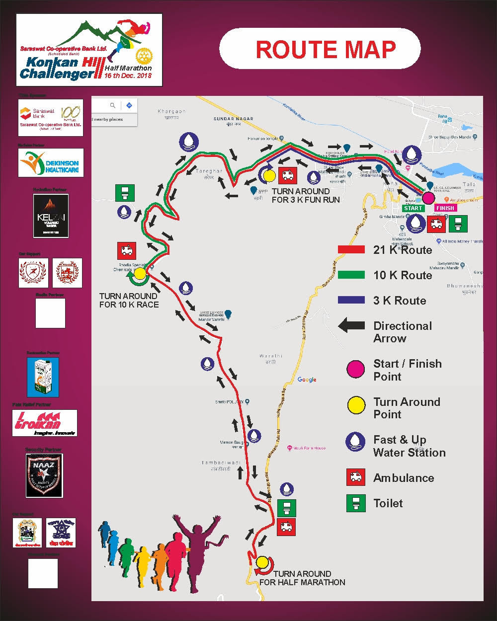
The race (21.095km) starts near the city hall at 6:00 am. It will be cold and foggy at the early morning as it is ususlly at that time of the year.
As you start running , you will first get a straight start with a flat route till 2.25 km. the route takes a sharp left turn at km no 2.
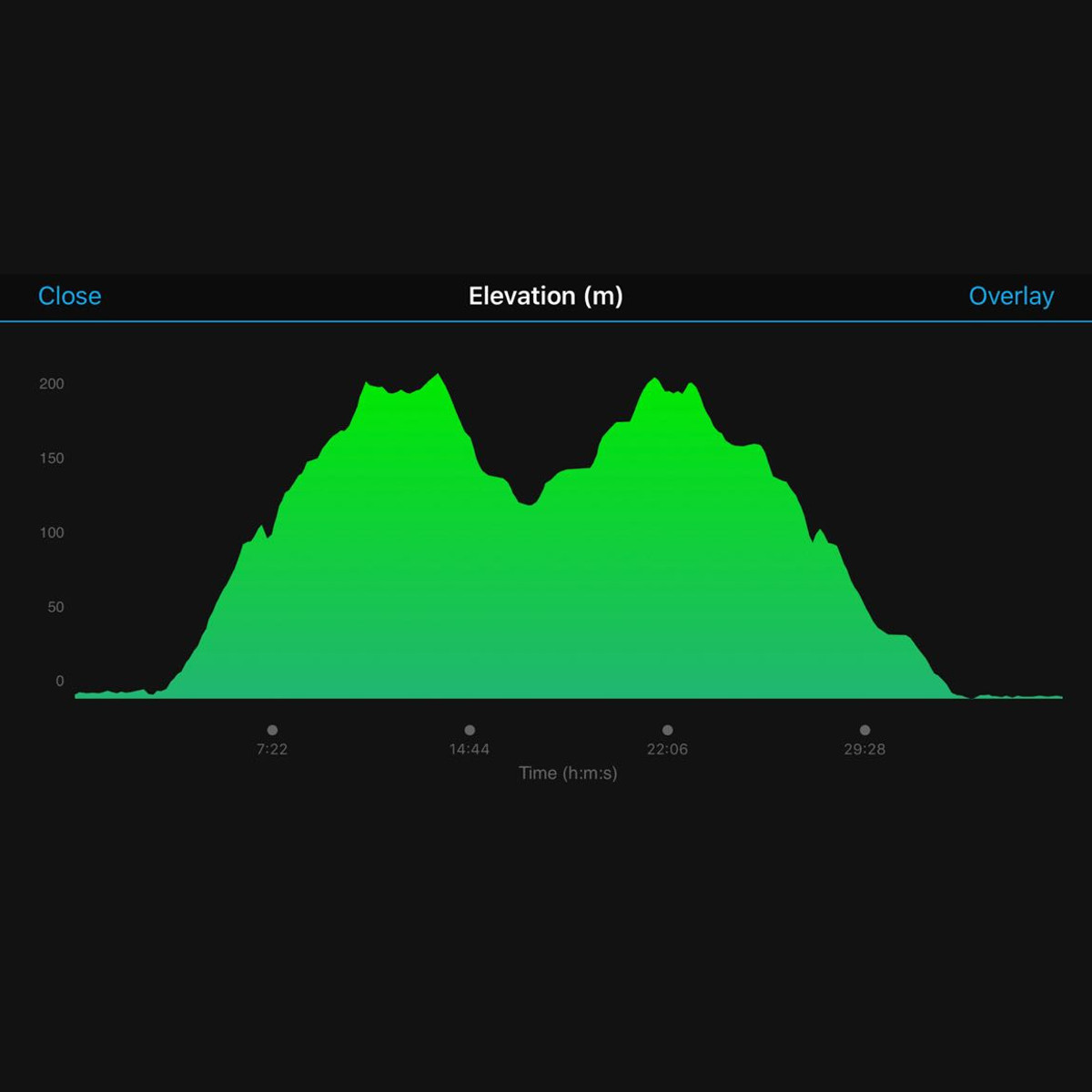
The incline of our hills starts here . The uphill is gradual at first , then it gets steeper. The route zig zags through the kalasgiri hills till 7 km. This is the major incline on our route( 2.25 till 6.75 km)
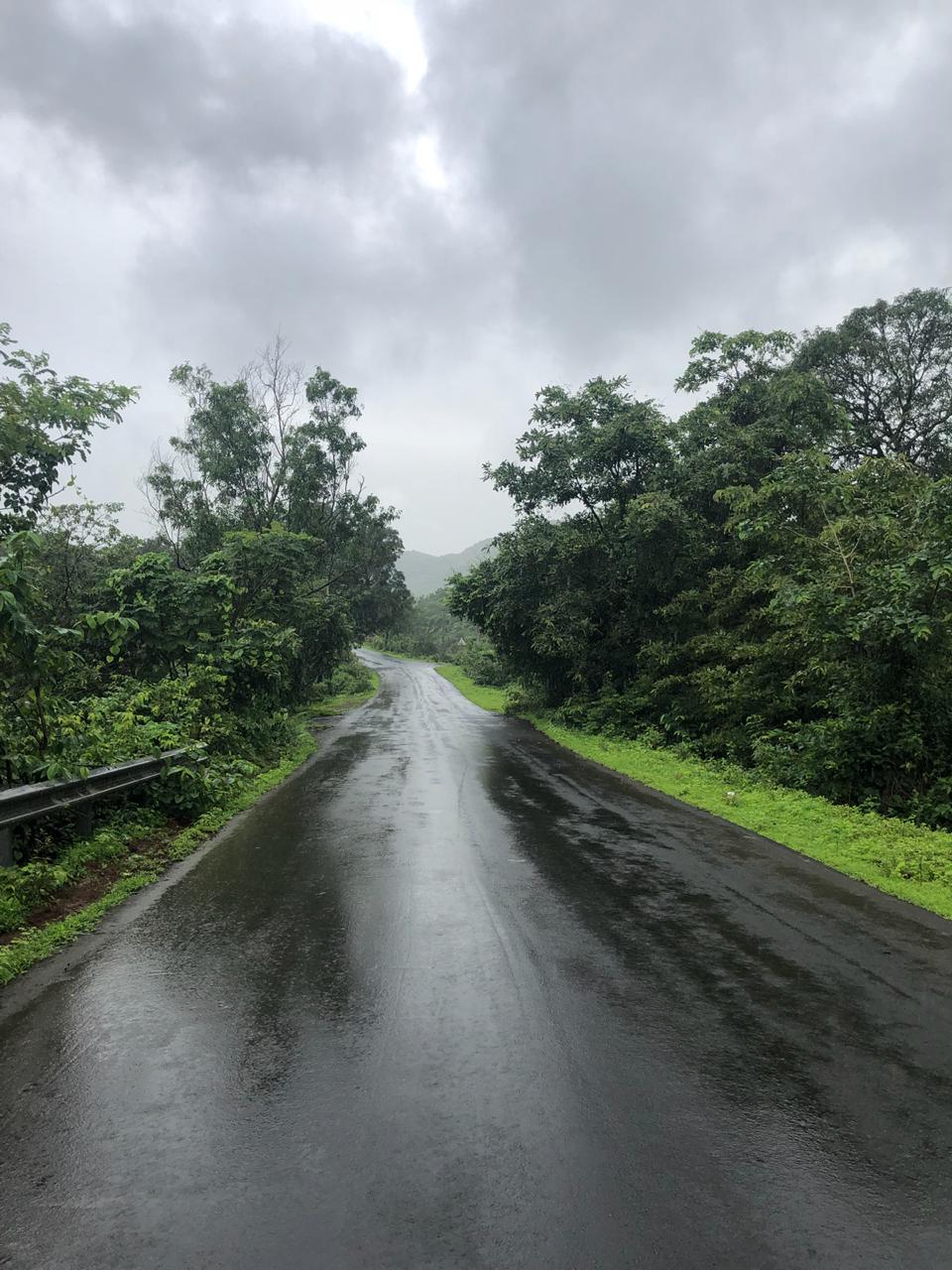
As u continue at the uphill run, you will experience mother nature in her full green bliss with breathtaking views of the valleys as u climb our hills. Runners will get a reprieve from the steep incline in between ,where the route is flat for a few metres at 2-3 locations .
After 7 km the route’s topography changes to rolling hills till km no 9.
It's a downhill thereafter till the turnaround . The route takes a sharp right turn at around 9.7 km , from where the incline of the downhill increases till the turnaround.
At the turnaround you will be greeted with two foggy valleys on either side of the road in a lush green climate .
Turn around now and head back to the finish line at the town hall. There is a sharp uphill after you turnaround , for around 750 metres. You will get a breather with a relatively flat track after that, and the uphill continues again ,for 700 metres more ,till km no 12. The next km (km mo 13)has rolling hills . You can relax after km no 13 as it's a full downhill from there till the finish line.
You will enjoy speeding down our green track in the hills from there till u reach km no 19.
Just before you reach the 19th km,the route takes a right turn as you head towards the finish line.
The last 2 km is a flat route and straight too. You can speed up here , and can give your best for a fast finish.
Elevation per K.M.
| Km no | Climb/Descent |
|---|---|
| 1 | 1m/0m |
| 2 | 0m/0m |
| 3 | 31m/0m |
| 4 | 48m/0m |
| 5 | 33m/5m |
| 6 | 53m/3m |
| 7 | 24m/0m |
| 8 | 28m/6m |
| 9 | 15m/5m |
| 10.0 | 0m/61m |
| 10.5 | 0m/35m |
| 11 | 35m/0m |
| 12 | 59m/0m |
| 13 | 14m/9m |
| 14 | 5m/24m |
| 15 | 1m/24m |
| 16 | 3m/50m |
| 17 | 3m/33m |
| 18 | 0m/49m |
| 19 | 0m/31m |
| 20 | 0m/0m |
| 21.1 | 0m/1m |

Route Elevation
Elevation gain -352 m,
highest point-208 m

Route Map
